
You are using an out of date browser. It may not display this or other websites correctly.
You should upgrade or use an alternative browser.
You should upgrade or use an alternative browser.
NEWS Somaliland latest developments
- Thread starter Manafesto
- Start date
- Status
- Not open for further replies.


FGS Army Commander Major General Maxamed Tahliil Biixi led liberation efforts in Lower Shabelle region and told the communities in the region that their efforts are increasing and the insurgency is on its last legs.
Half of hargeisa and burco are empty spaces. Look at this
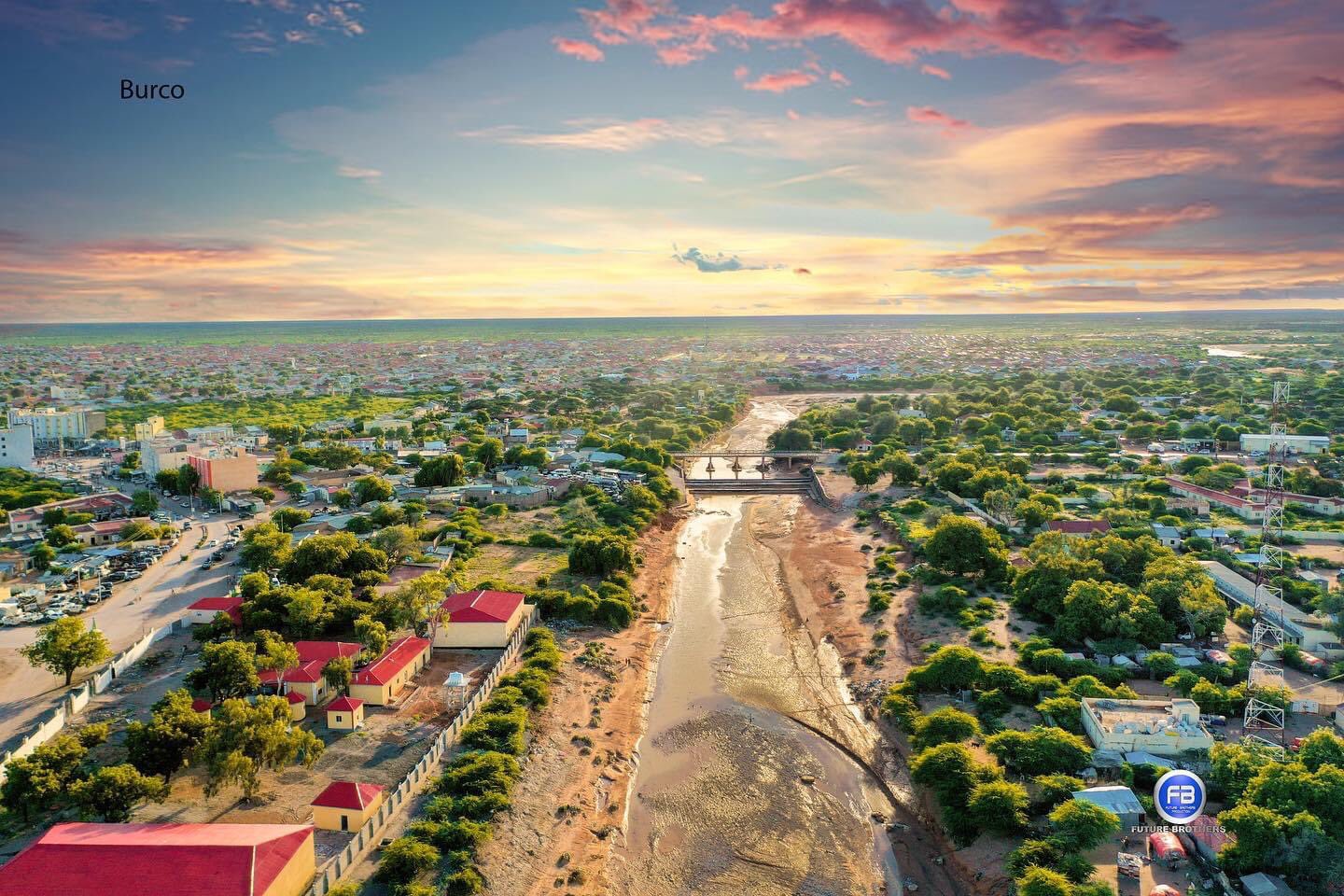
U need to deduct all that open space and bring the houses into 1 by 1 area sq 'area box' with no open-ness that's the true area sq of burco n hargeisa. There is like 100 meter by 100 meter yet 80% is trees and dirt and 3 houses. If u measure the whole city then u need to deduct that or else their counting the trees and open dirt.
Bosaso bay ku washteen every 1 area sq of bosaso is full, even if it's 12 sq km, it's jampacked, go walk thru bosaso 1 area sq you will see the manhattan effect, walk thru burco and hargeisa u will see 3 people in the same area. I am not going to bother to measure SL open areas since mogadishu which is far dense has to deduct 45 sq km, hargeisa wud be far more 80% for every area sq needs deducting.
Maybe some puntites can bother but I can't be bothered now. But draw 1 area sq box and shift each house of hargeisa into that, you will see how much space is left and deduct the whole city area sq, it's a truly tiny place. I did that for mogdishu to work out the 'openness' it lost 45 area sq of it's 90 area sq. Hargeisa wud be far more. Infact if u combined hargeisaa n burco houses into one area sq i don't think they can fill it, since each area sq only has 50 homes and lots of trees and wide ass laneways
It's not fair on Bosaso n Galkayo who fill 95% of their area sq yet 80% of hargeisa n burco area sq is nothing but trees and laneways with 5 houses. That means over-all hargeisa n burco r larger due to the sprawling effect. Look at sydney city it's 12000 area sq, yet it's 5 million. While singapore is 675 area sq km with 5 million. Bosaso is like singapore small area but large population, i see on the tv how jam packed it is constantly the roads, ppl, the buildings. Where-as hargeisa n burco is like country town with heaps of open space n less people its due to their measurements including trees not the houses by them. If hargeisa n burco boys drew 1 area sq box and shifted the houses of hargeisa area sq, u will see 80% unfilled, so 80% of your city is just trees and your true city is 20%
But mark my words measure 100 by 100 meter in hargeisa n burco u will see how much open-ness exists then multiply that across the 1 area sq to see how much open-ness exists and then deduct the same rate on the whole city. Hargeisa is around 10 area sq km if u removed the trees and open land. Estimations are done by drawing a 'well defined area sq' and then taking your area sq and placing it into the 'area sq' box, u will see bosaso fills it 99%, hargeisa 30%, so there is 70% loss for hargeisa n burco each area sq, that means for 5 area sq of hargeisa is truly 1 area sq of bosaso
Bosaso is second largest city when I measured it by area sq, hargeisa is third, galkayo fourth. Then the nomadic population well isaaq doesnt even bother in this population pool of 6 million since they rely on ogaden livestock kkkkk as they all cramp into hargeisa n burco with no NOMADIC COUNT. Proof is there isnt single dam outside hargeisa in all SL. PL has 20 dams. We have 20 to 1 for the nomadic population on isaaq. So for every 20 ppl in 6 million u give isaaq 1 nomad and repeat that across millions
Last edited:
SOMALILAND TRUCK OWNERS’ COOPERATIVE PROTESTS AGAINST UNFAIR COMPETITION
Hargeisa (PP News Desk) — Somaliland truck drivers’ cooperative at Wajale Dry Port protested against Ethiopia-registered trucks that transport vegetables directly to Hargeisa.
Truck drivers complain of a few “well connected people” who upended the trucking business model and transport vegetables directly from Ethiopia to Hargeisa. The standard business practice enabled trucks at Wajale Dry Port to transport vegetables from Ethiopia to Hargeisa.
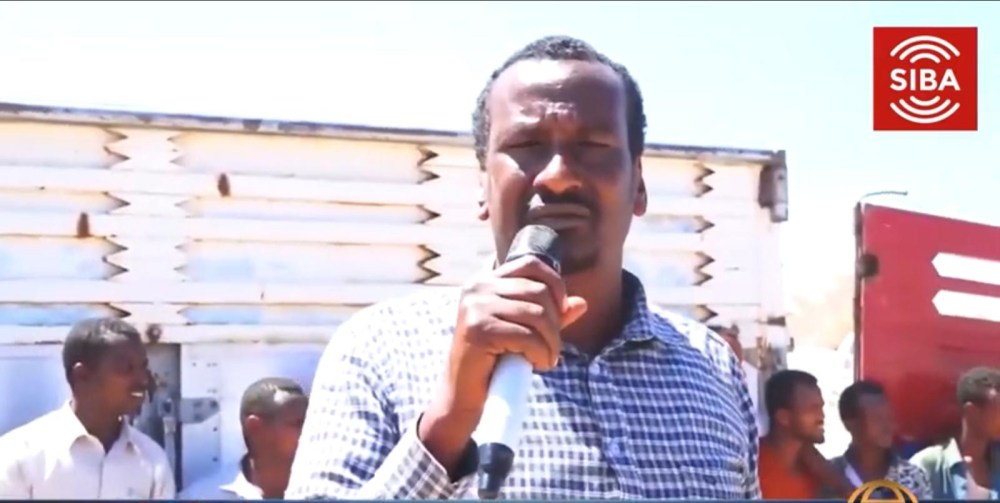
Himilo Cooperative Spokesman expressed dissatisfaction with an unfair competition policy that affected trucking businesses at Wajale Dry Port.
“As truck owners’ cooperative we express our dissatisfaction with the policy to grant one Habesha man, who owns fifty trucks, the privilege to transport vegetables directly from Ethiopia to Hargeisa while all our trucks are parked there without jobs” said a spokesman for Himilo Truck Owners Cooperative at Wajale.
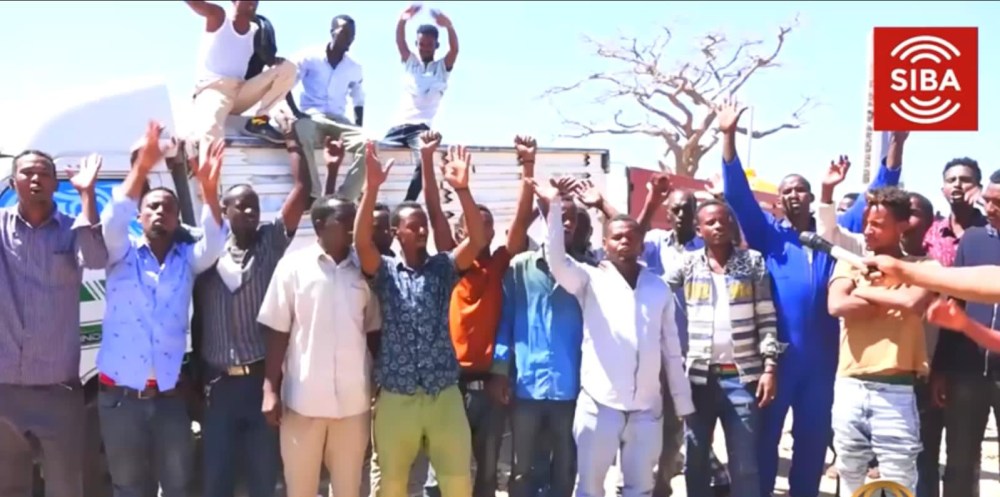
Trucking business owners at Wajale urge Somaliland Commerce Ministry to reconsider the decision to grant licenses to an Ethiopian owner of trucks
“The Somaliland Ministry of Commerce did not consult trucking business owners at Wajale Dry Port. While competition is in the interest of consumers, it is questionable to grant trucking licenses to a few well connected people who struck deals with Ethiopian truckers to transport vegetables directly to Hargeisa” said a business lecturer in Hargeisa.
“Somaliland truck drivers pay more tax. That should have been taken into account before the Commerce Ministry went ahead with the decision to give licenses to Ethiopian truck owners who partnered with some brokers in Hargeisa” the lecturer added.
© Puntland Post, 2020
Hargeisa (PP News Desk) — Somaliland truck drivers’ cooperative at Wajale Dry Port protested against Ethiopia-registered trucks that transport vegetables directly to Hargeisa.
Truck drivers complain of a few “well connected people” who upended the trucking business model and transport vegetables directly from Ethiopia to Hargeisa. The standard business practice enabled trucks at Wajale Dry Port to transport vegetables from Ethiopia to Hargeisa.
Himilo Cooperative Spokesman expressed dissatisfaction with an unfair competition policy that affected trucking businesses at Wajale Dry Port.
“As truck owners’ cooperative we express our dissatisfaction with the policy to grant one Habesha man, who owns fifty trucks, the privilege to transport vegetables directly from Ethiopia to Hargeisa while all our trucks are parked there without jobs” said a spokesman for Himilo Truck Owners Cooperative at Wajale.
Trucking business owners at Wajale urge Somaliland Commerce Ministry to reconsider the decision to grant licenses to an Ethiopian owner of trucks
“The Somaliland Ministry of Commerce did not consult trucking business owners at Wajale Dry Port. While competition is in the interest of consumers, it is questionable to grant trucking licenses to a few well connected people who struck deals with Ethiopian truckers to transport vegetables directly to Hargeisa” said a business lecturer in Hargeisa.
“Somaliland truck drivers pay more tax. That should have been taken into account before the Commerce Ministry went ahead with the decision to give licenses to Ethiopian truck owners who partnered with some brokers in Hargeisa” the lecturer added.
© Puntland Post, 2020
These id11r who I aptly term af-gashins in reference to all their 'green mouths'

I told you @Farjano-Walad this nigga is down to 'exports in veggies/fruits' in an ethiopia that is very green and fertile and 80% of it's citizens are farmers and producing enough of it and this af-gashin is trying to get slice from over-saturated market that is beyond 'excess' levels.
He losts his own SL markets with all SL truckers using Bosaso ports for imports and exports of livestock. While up to Hiiran to Warder the Central and North-Eastern products/goods/livestock are locked down to PL boys, his trying to run into ethiopia like an af-gashin in the veggie/fruits game marki 'laga awood roonaday' xitaa 'suuqisa' iska daa 'suuq' kale kkkkk.
His Suuq is only 10% of Somalia GDP and that is locked down to Bosaso port. $6 billion of the 7 billion GDP is in PL/JL or our mogadishu/hargeisa 'sectors'. These niggas know that $1 billion is mainly in hamar also and they think since Djibouti has the ethiopian market imports on lock, their trying to compete with amhara/oromo farmer who is a 'master' of this game and told him to f*ck off out of their market and stop polluting it with extra veggies/fruits and there u see their truckers all crying with no income.
Isaaqs are dumb they think 'currency' is money when it's the products/goods that r measured against currency, if u don't have products/goods u become an IDP camp like SL has become since no-one has any reason to give u currency for no product/good. I tracked the product/goods in Somalia with 9 million market locked down to PL. 1.7 million locked down to JL. The rest of that 4 million we own large products or services like electricty or money transfer that take large 'chunk' out of those 'service earnings' it's surely not a 'shop front' kkkkkk but 'sector' type level business with minimal players involved.
@Passenger @TabK how does it feel $6 billion dollars circulate in PL/JL trade corridor and the remaining $1 billion dollars which is 4 million market of bay/bakool/shabellaha/hamar/hargeisa we also taking a large chunk out of it thru amal/iftin combining their share total in money transfers and blue sky electricity taking large slice in electricity earnings. Wow no wonder u jealous of majerten you have $100 million dollar market kkkkkk. U want to split that across your isaaq population and see your GDP per capita?
Last edited:
Waryaa @Passenger @TabK u can't have money if u dont prove your market consumption first and the level of products/goods each year. Your market coverage is tiny even hargeisa each shop get's its shit from bosaso, forget burco/erigavo which is 100% market domination by PL. Even Hargeisa outside of indho dheeere the rest are tied to Bosaso, ask them where they dock down their shit and u will see. Bosaso is like manufacturing hub for 9 million people, the hub is the port. The port in Somalia is like 'manufacturing plant' even tho it doesn't produce it but thru 'trade' tied to one 'port' it's like bosaso port is huge factory for the nations services and industries, not a single part is outside our scope.
I’m from Somaliland and I don’t eat khat
I8mali my dad calls Isaaq 'af gashins' kkkk even tho he chew 'khat' but only like when he is in Somalia and not heavy 'usage' kkkkk but like twice or three times a week. He says everytime an Isaaq opens his mouth, u see 'green gashins' all over their teeths so he calls them 'af gashin' now. Their like the biggest consumers of khat in Somalis, they will chew u under the table my dad said
I don’t think it’s limi to isaaq reallyI8mali my dad calls Isaaq 'af gashins' kkkk even tho he chew 'khat' but only like when he is in Somalia and not heavy 'usage' kkkkk. He says everytime an Isaaq opens his mouth, u see 'green gashins' all over their teeths so he calls them 'af gashin' now
it’s because they have land that khat trees can grow in
like Yemen does
its not really limited to isaaq
@Karim Bosaso 12 area sq km actually is 95% properties with 5% ratio of unfilled, hargeisa n burco 60 area sq is simply 80% empty with open land and trees and 'large spaces'.
If we did the same for Bosaso and added that open space of hargeisa n burco, Bosaso area sq km wud sky rocket. So the only way to measure a city is not thru how big the city area is or else u wud need to tell us why singapore with 675 area sq km is larger then sydney with 12,000 area sq km.
So the sprawl of a city doesn't determine a city population. Isaaq will sit down with Majerten in Mogadishu with 'hawiye' as referee who will draw '1 area sq km' and tell Isaaq with Hawiye referee to monitor to draw the same 'boxed area' across a 'target' space in hargeisa n burco and count the houses, once we know the total house count, we will place that house count into 1 area sq km box and tell Isaaq your total houses only fill 'portion' of 1 area sq so that will be measured thru deduction of what open space is left and applied to the whole hargeisa n burco area sq km.
Nigga don't take a loss on smaller area sq or else singapore wud be smaller then sydney with larger area sq and that's clearly not true and the reason is simple, Singapore fills their land space 'fully' where-as sydney is open as f*ck with 80% unfilled.
@Karim if u notice in Bosaso also nearly every 10 properties has 'dabaq' showing the manhattan effect, where-as in Hargeisa n Burco the total dabaqs of the city is a handful where it's completely 'flat' residential with pockets of 'dabaq' in certain 'areas' of the town and then goes back to 90% ratio of flat residential, in Bosaso u see a dabaq per 10 properties forget 'each' area sq. Dabaq is a sign you got more ppl and can't spread out further and going higher like sydney cbd where they can't fit 17000 people in 2 area sq km without building 'high' and most people live in skyscrapers
I don’t think it’s limi to isaaq really
it’s because they have land that khat trees can grow in
like Yemen does
its not really limited to isaaq
Well all Somalis chew khat but it's well known an Isaaq consumption of it is usually the same as 5 people in the rest of the nation, hence their known as the 'kings of this game' and aptly termed 'af gashins'
Waqoyi Galbeed is the same size as 'nugaal' which is 26,000 Area SQ KM state, it's no different to Hobyo also since it's 26000 area sq km @Galmudug-State even though hobyo is called a 'district' it has the same population as nugaal or waqoyi galbeed if u combined their villages area sq km n nomadic population, wa hadi run loo hadlayo.
Waqoyi Galbeed is around 500k max but that is all 'settled' at large 95% rate since the land is to burnt or small for nomadic living at 'large population scale' as they wud 'over graze' it. Togdheer is twice the size of Waqoyi galbeed at @40,000 SQ KM but large chunk of 'togdheer' is 'cayn' and it's not a 'tuulo either' it's sitting on large land mass meaning heaps of towns/villages and nomads, at least 30% of togdheer is cayn so their finally population of 1 million, 300k is dhulbahante easy. Waqoyi galbeed is half togdheer size so it's 500k but at least it's all 'isaaq'.
700k plus 500k is measly 1.2 million Isaaqs and 'western erigavo' is tiny and not worth mentioning. Anything above 1.3 million for Isaaq is ludicurous and not based on land measurements. I say 1.3 to add that meagre western erigavo portion.
Awdal is around 500k, their 1.8 million Dir Waqoyi. Harti Waqoyi is 300k for Cayn. Those boys sit on 70000 area sq km which I know means 1.6 million since 45,000 SQ KM is 1.5 million population when u look at 'garissa'. Dir Waqoyi is only slightly larger by a few 'hundred' thousand. SL shud be shared that way. 1.5 million harti waqoyi, 1.8 million dir waqoyi.
Total northern population is no more then 3.3 million even though they claim 3.5 million, I doubt it nigga its not based on any 'real' observable basesline like Garissa template or 'area sq' km measurement of villages-cities nor nomadic count and water well tallying
Last edited:
I completely agree with your assessment as the world is filled with abundant examples illustrating that if a City has huge land area doesn't mean it's more populous than another city with lesser land area.@Karim Bosaso 12 area sq km actually is 95% properties with 5% ratio of unfilled, hargeisa n burco 60 area sq is simply 80% empty with open land and trees and 'large spaces'.
If we did the same for Bosaso and added that open space of hargeisa n burco, Bosaso area sq km wud sky rocket. So the only way to measure a city is not thru how big the city area is or else u wud need to tell us why singapore with 675 area sq km is larger then sydney with 12,000 area sq km.
So the sprawl of a city doesn't determine a city population. Isaaq will sit down with Majerten in Mogadishu with 'hawiye' as referee who will draw '1 area sq km' and tell Isaaq with Hawiye referee to monitor to draw the same 'boxed area' across a 'target' space in hargeisa n burco and count the houses, once we know the total house count, we will place that house count into 1 area sq km box and tell Isaaq your total houses only fill 'portion' of 1 area sq so that will be measured thru deduction of what open space is left and applied to the whole hargeisa n burco area sq km.
Nigga don't take a loss on smaller area sq or else singapore wud be smaller then sydney with larger area sq and that's clearly not true and the reason is simple, Singapore fills their land space 'fully' where-as sydney is open as f*ck with 80% unfilled.
For example: The population of Delhi, India is estimated to be around 20 Million and it has a land size of 1,295 sqKm. But Chicago dwarfs Delhi with its land size of 5,498 sqKm though it doesn't necessarily mean Chicago has bigger population than Delhi as Chicago's population stands at 8.3 Million.
Let's make a table to offer more illustrations to our readers;
| City (pop.) | Size in SqKm | City | Size in SqKm |
| Delhi (18M) | 1,295 | Chicago (8.3M) | 5,498 |
| Mexico City (17.4M) | 2,072 | Washington (3.9M) | 2,996 |
| Sao Paulo (17.7M) | 1,968 | Atlanta (3.5M) | 5,083 |
| City (pop.) | Size in SqKm | City | Size in SqKm |
| London (8.3M) | 1,623 | Detroit (3.9M) | 3,267 |
| Manila (15M) | 1,399 | Houston (3.8M) | 3,355 |
@Karim get in here waryaa. I already know the over-all true population in Somalia by using 'garissa' as template guide which was counted by kenya. I know u need 45,000 SQ KM of land for 1 million and use that as baseline to 'add or deduct' populations in Somalia using their land mass.
Majerteniya is 150,000 SQ KM = 3.3 Million since it's 3.3 times larger then Garissa total land mass which is a cool 1 million
Northern Somalia Dir Waqoyi/Harti Waqoyi = 3.6 million for their land mass of 169,000 SQ KM. That is 3.6 times larger then Garissa.
South/Central Somalia beginning at Galkacyo to Kismayo = 8 million for their land mass of 350,000 SQ KM, It's 8 times the size of Garissa.
8 million for South-Central Somalia is accurate in my eyes. They have 350,000 SQ KM
3.3 million for Majerteniya is accurate. 150,000 SQ KM
3.6 million for Northern Somalia including harti/dir waqoyi combined is accurate since they only have 165,000 SQ KM
Either way the South/Central portions will form 55% of Somalia parliament. Majerteniya will form 22%. Northern Somalia as Harti/Dir Waqoyi will form 25% of Somalia power-sharing. That is very 'cadalad' and anything below this power-sharing mechanism is going to lead too more time wasting. Infact u saw the same thing with SYL where it was 75% of the national MP cause it included 50% south and 20% Majerteniya as the base of the party. SNL portion broke down into USP-SNL which further dented their over-all representation not to mention other smaller parties
Last edited:
@Karim look at Somalia parliament percentages back in 1960-69, SYL was always 80% due to the south/east combining and SL split into USP/SNL denting their chances which were 'slim' anyways with the south being 2.5 times larger then the East.
If Majerten is 3.3 million the South is 2.3 times our population since their 350,000 SQ KM is 2.3 times larger then our 150,000 SQ KM. So it's 3.3 million x 2.3. They are 7.5 million 'easily' with a scope to '8 million' maximum. Where-as Majerten is 3 million easily to scope of '3.5' Million maximum. Either way they will always be around 2.3-2.5% larger then us in parliament seats.
Northern Somalia will be around what they truly represent 3.3 - 3.6 million that includes USP/SNL combination which is fractured like it was in 1960s and still is today and Somaliland is trying it's hardest to unite that bloc and then use it as 'power negiotation' tool to increase Isaaq power which obviously us 'vicious' majertens will never allow and why they hate us the 'most' and focus all their 'topics' in Somalispot on 'majerten' as they know we are vicious in our 'measurements' and accurate as f*ck.
Isaaq is 10% of Somalia as far as Majerten is concerned and won't allow they use 'Harti' to bolster that to 25% of the power-sharing since their 'harti' they are Puntites and we harti will bolster ourselves to 30% power-sharing mark with 22% Majerten 8% dhulos/warsan which is 'national' representation quota and we won't accept any less and will allow Somalia to continue in it's stalemate for all we care.
Majertens are like this and Isaaq knows it nagama 'hos bixi karan'

As for how that 30% will be shared of Somalia national quota for Harti. It's 150,000 SQ KM for Majerten and 70,000 SQ KM Harti Waqoyi, we take our 220,000 SQ KM portion of the national land mass and demand the parliament be divided into 3 sections with one section called 'HARTI' and 30% totally reserved. The remaining 70% we demand 15% is called Jubaland.
Within Harti portion we need to split it 150,000 SQ KM/70,000 SQ KM with 46% assigned to Warsangeli/Dhulbahante and 64% assigned to Majerten. Which is the current power-sharing method in PL parliament with dhulos 17, 9 warsan, mj 31. 17 plus 9 = 26 out of 66 mps which is 40% they truly deserve 46% and 64% MJ wa hadi 'xaqiiq' loo hadlayo as we are 3.3 million and their 1.5 million
We demand our 45% of Somalia parliament 'wing' and 55% can be shared between rahanwayn-hag-dir waqoyi.
If Majerten is 3.3 million the South is 2.3 times our population since their 350,000 SQ KM is 2.3 times larger then our 150,000 SQ KM. So it's 3.3 million x 2.3. They are 7.5 million 'easily' with a scope to '8 million' maximum. Where-as Majerten is 3 million easily to scope of '3.5' Million maximum. Either way they will always be around 2.3-2.5% larger then us in parliament seats.
Northern Somalia will be around what they truly represent 3.3 - 3.6 million that includes USP/SNL combination which is fractured like it was in 1960s and still is today and Somaliland is trying it's hardest to unite that bloc and then use it as 'power negiotation' tool to increase Isaaq power which obviously us 'vicious' majertens will never allow and why they hate us the 'most' and focus all their 'topics' in Somalispot on 'majerten' as they know we are vicious in our 'measurements' and accurate as f*ck.
Isaaq is 10% of Somalia as far as Majerten is concerned and won't allow they use 'Harti' to bolster that to 25% of the power-sharing since their 'harti' they are Puntites and we harti will bolster ourselves to 30% power-sharing mark with 22% Majerten 8% dhulos/warsan which is 'national' representation quota and we won't accept any less and will allow Somalia to continue in it's stalemate for all we care.
Majertens are like this and Isaaq knows it nagama 'hos bixi karan'
As for how that 30% will be shared of Somalia national quota for Harti. It's 150,000 SQ KM for Majerten and 70,000 SQ KM Harti Waqoyi, we take our 220,000 SQ KM portion of the national land mass and demand the parliament be divided into 3 sections with one section called 'HARTI' and 30% totally reserved. The remaining 70% we demand 15% is called Jubaland.
Within Harti portion we need to split it 150,000 SQ KM/70,000 SQ KM with 46% assigned to Warsangeli/Dhulbahante and 64% assigned to Majerten. Which is the current power-sharing method in PL parliament with dhulos 17, 9 warsan, mj 31. 17 plus 9 = 26 out of 66 mps which is 40% they truly deserve 46% and 64% MJ wa hadi 'xaqiiq' loo hadlayo as we are 3.3 million and their 1.5 million
We demand our 45% of Somalia parliament 'wing' and 55% can be shared between rahanwayn-hag-dir waqoyi.
@Karim Waqoyi Galbeed is the Same Size as Awdal around 21,000 SQ KM each. So do not call them 'north west' since the north-west is split half and half between Isaaq n Samaroon. And the Eastern SL is 'Half n Half' with Isaaq and Dhulbahante/Warsangeli.
Their true title is 'north central' zone not northern somalia nor eastern somaliland or north western somaliland. North west is whopping 28000 plus 21000 x 2 states awdal/waqoyi galbeed and it's split evenly 50/50 for 49,000 SQ KM.
So it's only 10% increase on Garissa Total giving it 1.1 million for both and Isaaq is 'half' only. Eastern Somaliland is total 50,000 SQ KM for Sanaag and Togdheer is 40000. That's 90,000 SQ KM ma garatay? that shit is split with 70,000 SQ KM reserved to Hartis and I know this thru deduction reasoning since PL is 220,000 SQ KM and North-East is 150,000 SQ KM, the remainder is 70,000 SQ KM meaning sool/sanag/cayn so that portion of 90,000 Eastern SL SQ KM is purely 70,000 SQ KM Harti darods with Isaaqs only 20,000 SQ KM.
That's why if you combine their eastern SL portion of 20,000 SQ KM plus add that to their waqoyi galbeed 25000 SQ KM and add 'caynabo'.
Your looking at 50000 SQ KM which means their around 1.1 million 'maximum' and Samaroon is 500k for half that land space and Hartis are 1.5 million.
So these Nigga parliament gave 80% of SL representation to essentially 50,000 SQ KM population pool, when all they represent in SL is truly 50000 SQ KM or 1.1 million.
SL total area if you assume 90,000 SQ KM for eastern SL and 50,000 SQ KM for western SL. It's total of 140,000 SQ KM which is less then 'Majerten' land of 150,000 SQ KM. It's Sool that makes up the rest for them and is 26000 SQ KM. So let's assume SL is 165000 SQ KM total.
Let's divide that up how PL parliament divided it's powersharing. U wud expect Isaaq is 27% maximum of Parliament. Harti Waqoyi should be 42%. Samaroon is 15%
I am adding up SL 5 regions Togdheer is 40,000, Sanag is 50000. That's 90,000 SQ KM for eastern SL. Awdal = 21000 SQ KM, Waqoyi Galbeed 28000 SQ KM for a total of 50,000 SQ KM.
So that's a total of 140000 SQ KM. Your looking at no more then 90000 sq km plus 52000 sq km for western sl which is total of 140-142000 SQ KM total land mass, so I am not sure where they get the idea SL is 169,000 SQ KM.
OOPs I forgot to add 'sool' my bad that cud mean an extra 26000 SQ KM itself giving them 165000 SQ KM total. But u see what I mean. Isaaq is 50,000 SQ KM, it should get less then dhulos/warsan share of 42% and Isaaq 30% while Samaroon is 15%. That is 'true' cadalad ama SL haku noqdo 'north central powersharing' since it's not reflecting the true SL it claims but only the 'center' regions. Dir waqoyi shud get 30% Isaaq plus Samaroon 15% which is 45% of the parliament and Warsan/Dhulos gets 42% of the parliament. Then it looks like 'real' somaliland kkkkk and Majerten wud shut up and says 'meeshu runta ayaa ka muqdo'
Last edited:
- Status
- Not open for further replies.