
James Dahl
VIP
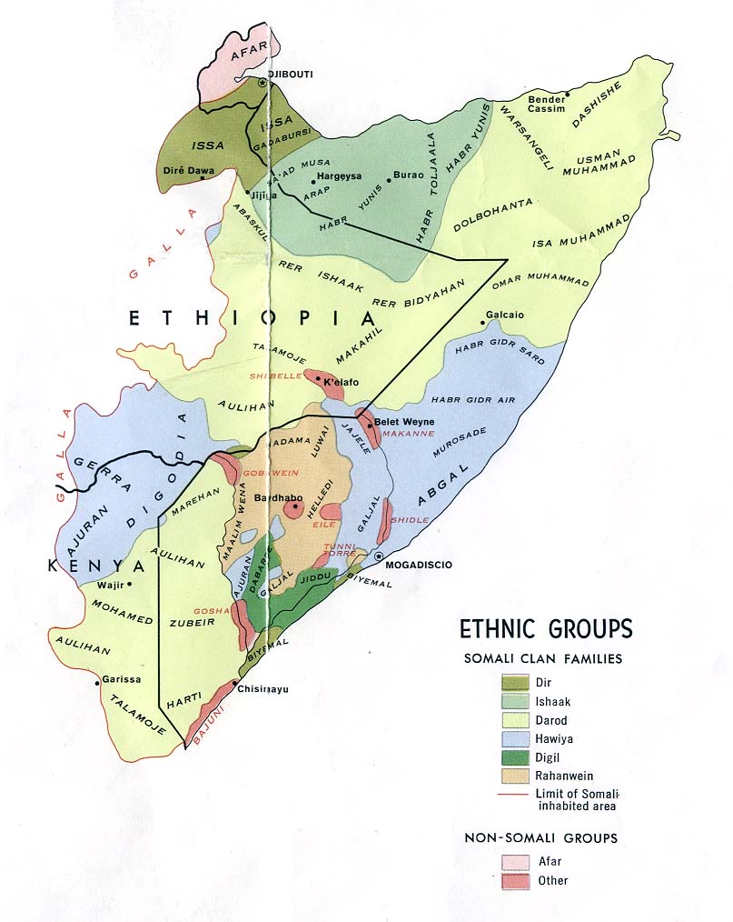
I've read that already, the 20kya identification is literally based on pottery shards and alleged similarity of Eyle pottery. This is too thin to base any kind of identification on.
I haven't read the first one you link to but the summary doesn't mention Eyle and you are making a connection that isn't there. You are making the following logical jumps:
In ancient times people lived in Somalia prior to the current population
You have decided these are San people, despite San people being a modern ethnic group from South Africa and not an ancient people lost in time
San identification based on click sounds, except that many Cushitic languages have click sounds
Eyle you have decided are San people, who you have also decided are the same as the ancient people, who you ALSO decided were displaced by Cushitic people.
The jumps from one to the other, to the next are not logical they are based on some weird belief you have about aboriginal populations and you just use confirmation bias to move from one point to the next and fill in the gaps in your head.
It's not good enough to just hand wave away all the problems with your theory there are gigantic holes that are tens of millenia wide that you are just glossing over like they're nothing.
This isn't evidence this is just documents.


 Your second link is a travelogue!