
Did you know that Ceerigabo district is majority Harti? At least land wise. People think it majority Isaaq because the district seat is an Isaaq town.
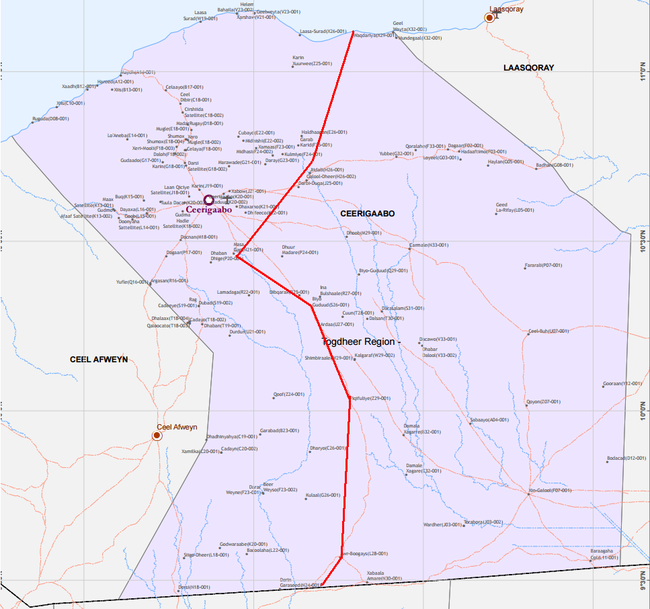
I was going to correct you with an accurate map but Mudane Bohol beat me to it.Lol That map is so skewed, it's ridiculous.


 . Ceerigaabo in terms of population, it's majority is HY by far. The dynamics has changed my friend. Even your ppl acknowledged this with the agreements they've signed with HY.


