Most of those were just estimates. The British never actually did a full census. Desperate eydoor jeegani desperate for approval from these Darood.
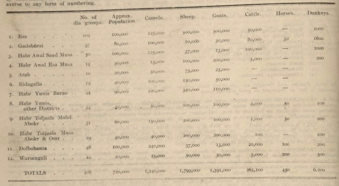
This was another fake census calculated on ownership of domesticated animals:
It's all estimates. The only conclusive census are from the UN.
Even the census you shown is erred, the Ciise were actually 35,000 and not 55,000. Showing you the discrepancies. Focus on the mistakes in these 'stats'.
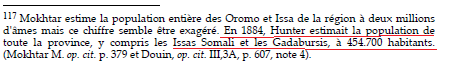
Hunter estinated that the western Dir clans (Issa and Gadabursi) combined were over 400,000 in 1884.
Eydoor Jeegani who runs to aabe British census the only way to be sure today is UN Census who dont estimate on favour of certain clan like your aabe British did. Also most Gadabuursi live in Ethiopia. So ones in borders of Somaliland are not even half of the total motherfucker.