Right now in somalia , its pretty much agreed that anything above Galkacyo is the north ( waqooyi ) Beledweyne and below to be the south ( konfuur ) and all in between is central Somalia ( dhexe ) . Of course its a bit more complicated but rough estimations
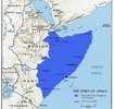
My question is what you think the north south divide would be if we based it on Somaliweyn . What areas would be grouped together for north/south/east/west . Especially considering how much wider the country would be . Also consider cultural / linguistic differences
My question is what you think the north south divide would be if we based it on Somaliweyn . What areas would be grouped together for north/south/east/west . Especially considering how much wider the country would be . Also consider cultural / linguistic differences
Attachments
Last edited:

