Bohol
VIP
It is geographically impossible for Awdal to form state with Sool and Sanaag
Not really. For example Northern Awdal and Sanaag share sea it is a bit like USA/Alaska even closer. You can travel by boat few hours from Maydh to Zeylac straight.
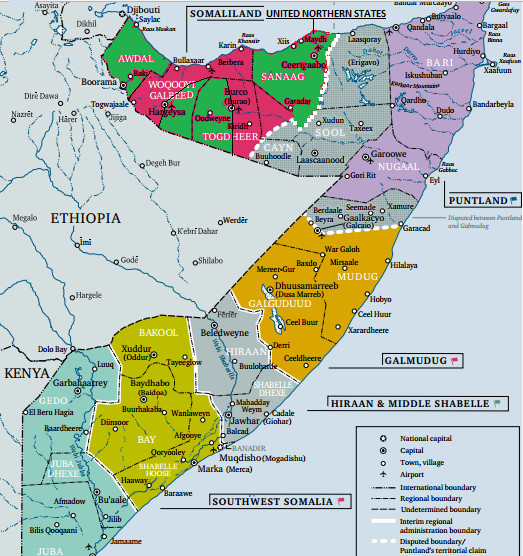
This is my vision for northern Somalia (3 federal states).
Green = Northern Somali States - Garhajis/Gadabursi comprising of Awdal, Western Togdheer, Eastern Maroodijeex/ Sanaag
Red = Somaliland region federal state- HJ/HA/other smaller clans comprising of Gabiley district, Western Hargeisa district, Berbera district and eastern Burco.
Grey - Khaatumo = Warsangeli/Dhulbahante comprising of Las Anod district, Badhan district, Buhoodle district, Laas Qoray district


 that’s not all he did either. War wuxu been badna marwo bohol Allah ha cafiyo amiin