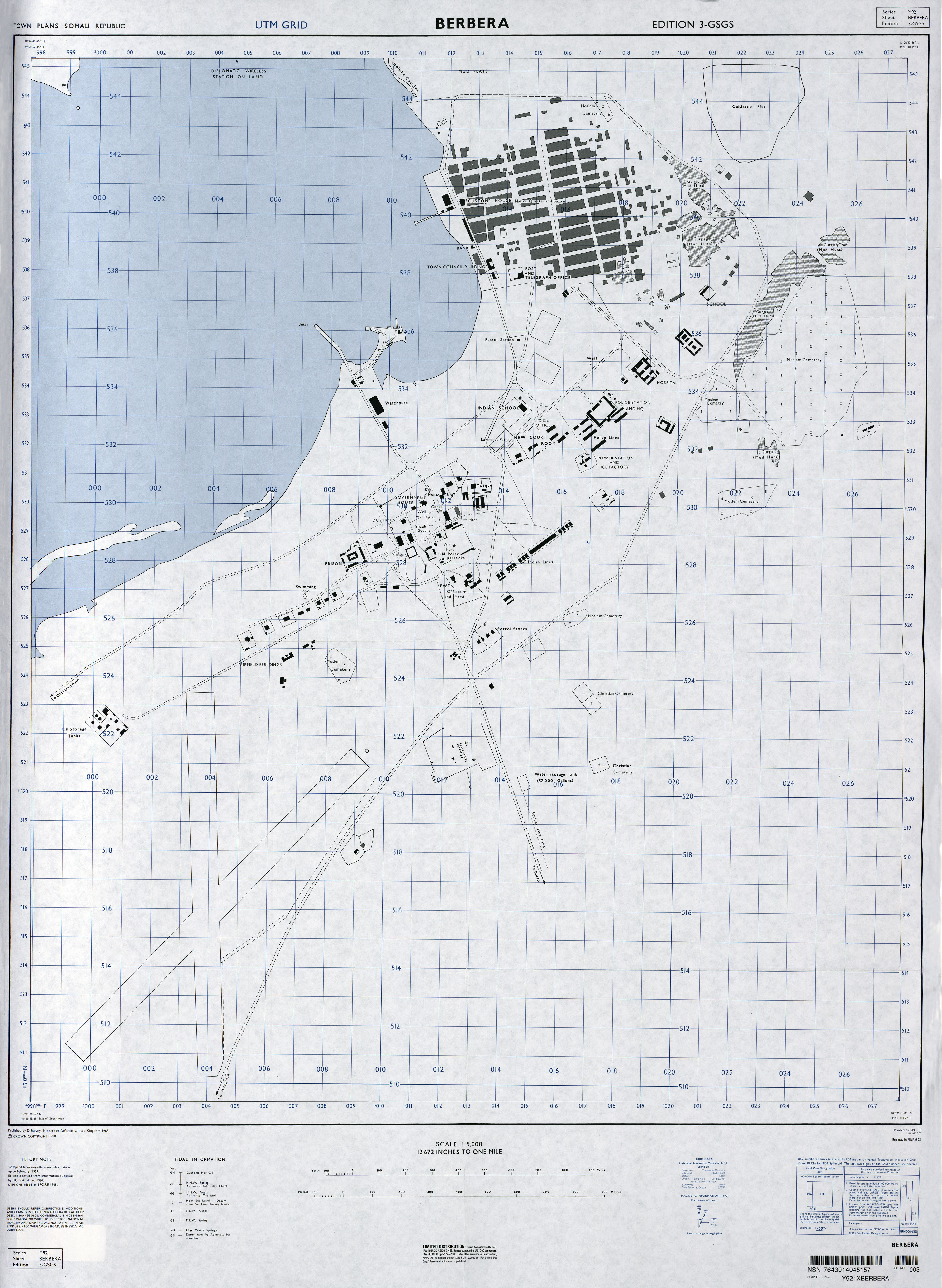
As we can see here, the current/modern port hasn't been built yet as seen on grid ref: 536008 which shows the outlying jetty.
1968:
Present:

Ironically, this civilian survey was conducted by U.S based NIMA (National Imagery and Mapping Agency) one year (1969) before the Soviets were going to begin their innitial development of Berbera:
https://books.google.co.uk/books?id=nfKeCwAAQBAJ&pg=PA103&lpg=PA103&dq=berbera+port+soviets&source=bl&ots=5VTWVmpuH0&sig=2Y9y3jan_JZLy9pd3THokGOY2tM&hl=en&sa=X&ved=0ahUKEwjU-vfZsvrUAhUlAcAKHYoADNE4ChDoAQglMAM#v=onepage&q=berbera port soviets&f=false
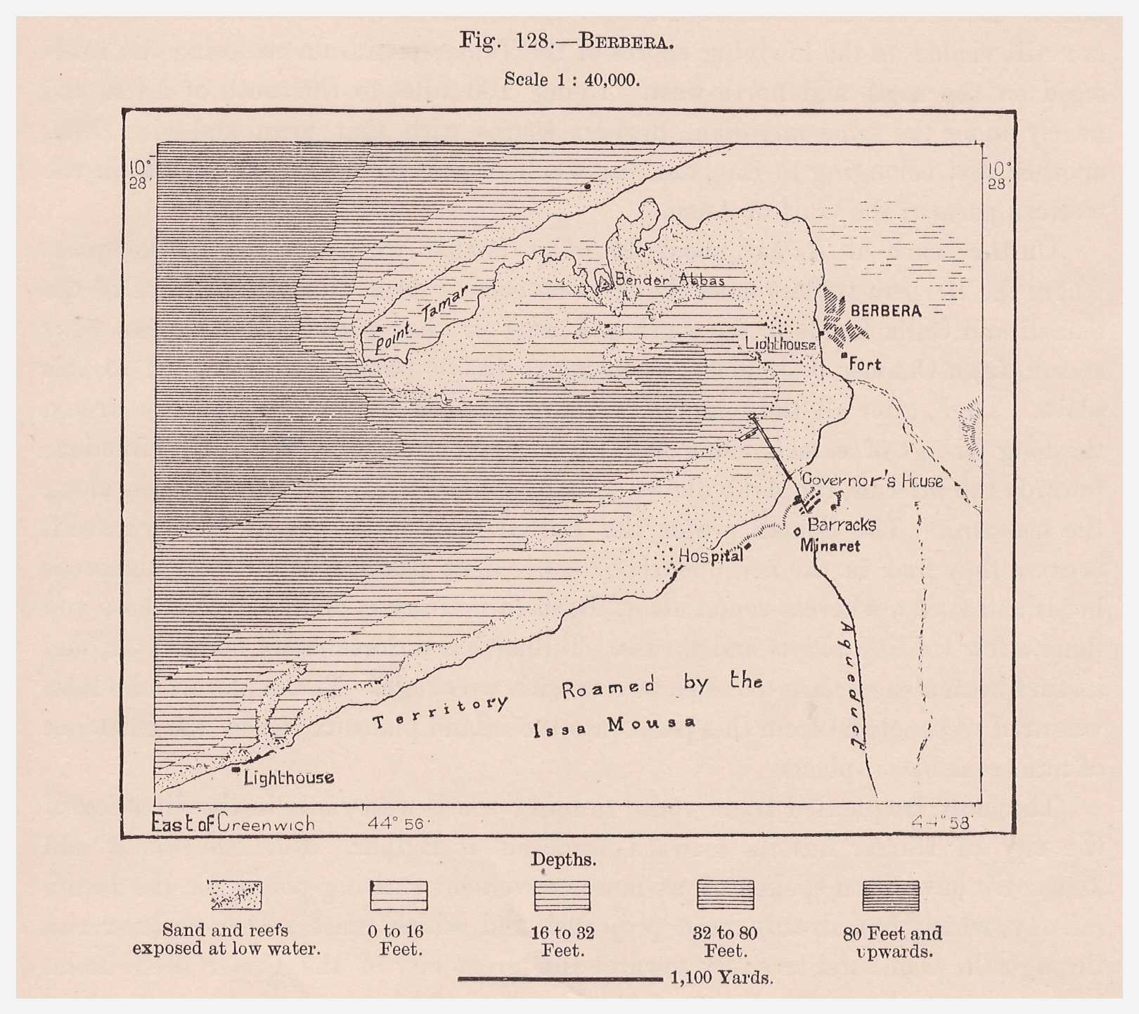
Moving on, we can see that Berbera has always had a settled, indigenous population of local Somalis (Habar Awal) as seen on the map as "native quarter" to the east of the shaab (shacab) or British area.
This area is where the historic Berbera of old is located and where the bay and old jetty (grid ref: 534010 - 540012) was used to offload goods from dhows as well as setting off to trade with the wider world:
Finally, I'm gonna finish off the OP with this:
March 17, 1985|CHARLES MITCHELL | United Press International
But the Somali boasts of Berbera's strategic importance now ring hollow. The Americans have stopped talking. The Central Command set up headquarters in Florida and took with it the enthusisam for developing the town.
With only a few minor improvements--mostly on the civilian and not the military side--the "stragetic" airstrip and port of Berbera have been left pretty much as they were found after the departure of the Soviets.
A $100-million commitment made by the United States to improve Berbera when the 10-year access agreement was signed in 1980 has never been fulfilled. It probably never will be.
http://articles.latimes.com/1985-03-17/news/mn-35349_1_somalia
Much of what we see with Berbera port is what the Soviets built during their tenure according to the above?

@Foreman @Garad @SultanuuFicaan what do you guys think? View attachment 22776
Last edited: