Yubbe is the border between HY and Warsan. Masagan and Midhisho are actually Habar Yoonis tuulos.
@Rush posted a realistic map, sxb.
Gadweyne a sub-clan of Muuse Ismail (HY) completely surround Ceerigaabo and the tuulos you see around exclusively belongs to them.
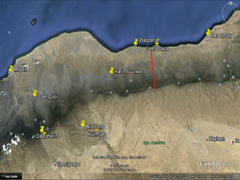
Geel Weyta is the coastal border area between HY and Warsangeli in case you didn't know. Waqderia which belongs to Gadweyne is closer to Las Qoray than it is with Maydh.
"This land belongs in part to the Warsingali. Westwards of Las Galwayta, which is the frontier, the Habar Yunis lay claim to the coast"
Source: Richard Burton. First Footsteps in East Africa.
Also, Sanaag is not lawless. Somaliland controls majority of the region. Just eastern Sanaag (warsangeli territory) is under Maakhir state and currently free from SL/PL rule. As for Sool, Somaliland controls all of it. Caare is some moron terrorist hiding in the mountains, he's irrelevant in this discussion. No different to Al-Shabaab and ISIS hiding in Galgala and Qandala mountains in Bari region of Puntland.