What’s Khaatumo true borders?

hello guys

I just wanted to know what’s the true extent of Harti lands. Which is the western most parts of Somaliland they live? Is there a credible map that demarcates these lines.
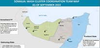
Are these maps accurate?

 

Attachments

  • 0265FAF5-49FB-46DA-9CAE-7DFAA97A6E41.jpeg
    0265FAF5-49FB-46DA-9CAE-7DFAA97A6E41.jpeg
    61.9 KB · Views: 167

attash

Amaan Duule
Pretty accurate, I think. All of Sool except for Caynaba district, Buuhodle district in Togdheer, and everywhere in Sanaag east of Ceerigaabo.

1705627834214.png
 
hello guys

I just wanted to know what’s the true extent of Harti lands. Which is the western most parts of Somaliland they live? Is there a credible map that demarcates these lines.
Are these maps accurate?

IMG_1215.jpeg

As is evident my rivals who made this map are using the divide and conquer tactic against certain qabiils including mine but you can see that Harti border each other to the northeast and Isaaq to the west
 

mohammdov

Nabadshe
View attachment 311687
As is evident my rivals who made this map are using the divide and conquer tactic against certain qabiils including mine but you can see that Harti border each other to the northeast and Isaaq to the west
This map is not realistic
Xarsi cismaan/hy They are the ones who reach Danood and haro xodayod They meet there with makaahiil and Dhulbahnte
Only in Bali Cali They meet Dhulbahnte
In the rest of land they border Abraahiim and reer dalal
Ask someone who has traveled through these lands 😂
 

Ximan iyo Xadeed

Sanaag
VIP
Pretty accurate, I think. All of Sool except for Caynaba district, Buuhodle district in Togdheer, and everywhere in Sanaag east of Ceerigaabo.

View attachment 311680

Wrong

Damala Xagare , Dhabar Dalool, Qol, Torabora, west of Sibaayo or Dureera , Shimbiraale, Darasalaam, on google its Qaarar btw not Dhoob , Biyo Guduud or Shin Biraale its all ours.

We also live in Madare
 
Last edited:

Ximan iyo Xadeed

Sanaag
VIP
View attachment 311698
View attachment 311699
View attachment 311701View attachment 311703
use Google map This is borderline between muuse ismaciil and Sacad yoonis and dh&wg
Waqderiya is Warsangeli you don't live there and Dhoob falls under Qaarar, stop bragging about a hamlet. If not for our horgals you wouldn't build a cariish there 😂

Dhuur Madare is sandwiched by us on all sides Ceeldheere 2km off West , Qaarar 8km East , Dhaxamo plains in the North and the South its Biyo Guduud


Dabablehe is by Midhisho its 90% Warsangeli, you're a magan in the East lil bro.


In the east of Degmada Ceerigaabo you're a magan who over stayed their welcome
 
Last edited:

mohammdov

Nabadshe
Waqderiya is Warsangeli you don't live there and Dhoob falls under Qaarar, stop bragging about a hamlet. If not for our horgals you wouldn't build a cariish there 😂

Dhuur Madare is sandwiched by us on all sides Ceeldheere 2km off West , Qaarar 8km East , Dhaxamo plains in the North and the South its Biyo Guduud


Dabablehe is by Midhisho its 90% Warsangeli, you're a magan in the East lil bro.


In the east of Degmada Ceerigaabo.
Cershiida Historically even it was lived by muuse ismaciil They are the ones who live there today and build the road there.
Dabablehe is by jiidali also kulmiye north jiidali
Muuse Tuurwaa himself He was buried in east cershiida It is the land of their ancestors 😂
If Dabablehe is 90%wg then you now that jiidali is 50% Mu and 50%harti
Waqdriya There's no one living there now
Anything west of it is for muuse ismaciil xarshow& laaasurud
There are no Magans who build villages magan just grazes and returns to his land and does not settle
You see the map of all these villages. We live in them and build roads and water wells in them You can claim it by mouth only by talking Sxb It won't change anything 🤣👐
 

Ximan iyo Xadeed

Sanaag
VIP
Cershiida Historically even it was lived by muuse ismaciil They are the ones who live there today and build the road there.
Dabablehe is by jiidali also kulmiye north jiidali
Muuse Tuurwaa himself He was buried in east cershiida It is the land of their ancestors 😂
If Dabablehe is 90%wg then you now that jiidali is 50% Mu and 50%harti
Waqdriya There's no one living there now
Anything west of it is for muuse ismaciil xarshow& laaasurud
There are no Magans who build villages magan just grazes and returns to his land and does not settle
You see the map of all these villages. We live in them and build roads and water wells in them You can claim it by mouth only by talking Sxb It won't change anything 🤣👐


Dabablehe is 90% Warsangeli from DamalJabay on the Waqderiya side all the way outside Midhisho in Lasa Surad side if thats not 90% Warsangeli idk what is 😂

Notice how you can't claim Dabablehe its always the small strip of Shurko

Even Marawade its shared 4 ways , Warsangeli , Gahayle, Dhulbahante and then MI.

There is no such thing as borders in East Ceerigaabo waa sheeko cusub.

Its dabablehe and birxamar, not dabablehe iyo shurko 😂
 
Last edited:

mohammdov

Nabadshe
Dabablehe is 90% Warsangeli from DamalJabay on the Waqderiya side all the way outside Midhisho in Lasa Surad side if thats not 90% Warsangeli idk what is 😂

Notice how you can't claim Dabablehe its always the small strip of Shurko

Even Marawade its shared 4 ways , Warsangeli , Gahayle, Dhulbahante and then MI.

There is no such thing as borders in East Ceerigaabo waa sheeko cusub.

Its dabablehe and birxamar, not dabablehe iyo shurko 😂
The important thing is that you know your border The reconciliation in 1993 determined the lands on which each tribe could build villages and the lands that were considered common grazing lands on which they could not build.
midhiasho to kulmiye, Karin tuurwaa all the way to laaasurud
We have the mountains, the coast, and anything under the mountains (in jiidali)is shared It's like this
 

Trending

Top