You are using an out of date browser. It may not display this or other websites correctly.
You should upgrade or use an alternative browser.
You should upgrade or use an alternative browser.
An Archeologist Made A Mapping Of Thosands Of Archaeological Structures In Puntland And Somaliland
- Thread starter killerxsmoke
- Start date
about to post this, somalia is the least researched african country
 why the niggas in the comment section asking about ''dna test of the burial'' do they think it's not somali what inferiorty complex
Keep it a boqol
VIP
My father was Aayrabwhy the niggas in the comment section asking about ''dna test of the burial'' do they think it's not somali what inferiorty complex
Garaad diinle
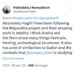
Quite remarkable this map clearly outlines a presence on large parts of the coast meaning somalis were coastal people that were always trading with the outside word. The concentrated dotes cover an area equivalent to the nederland. I initially thought that these dotes would be more spread out since somalis in the interior were nomads always on the move looking for greener pasture.
The reason may lay in the traditional story of araweelo. It's been said that in the time of araweelo northern somalia stretching from zaylac to bari were completely green full of vegetation and trees. This means somalis moved less and were more of an agro-pastoralist people. For all we know they might've cut the trees for trade and over grazed the land which turned northern somalia's climate into an semi-arid one.
The reason may lay in the traditional story of araweelo. It's been said that in the time of araweelo northern somalia stretching from zaylac to bari were completely green full of vegetation and trees. This means somalis moved less and were more of an agro-pastoralist people. For all we know they might've cut the trees for trade and over grazed the land which turned northern somalia's climate into an semi-arid one.
Last edited:
SL?? Ethiopia djibouti and somaliyeefour countries?
In the laas geel paintings there are giraffes on there, clearly showing that the area was more greener then beforeQuite remarkable this map clearly outlines a presence on large parts of the coast meaning somalis were coastal people that were always trading with the outside word. The concentrated dotes cover an area equivalent to the nederland. I initially thought that these dotes would be more spread out since somalis in the interior were nomads always on the move looking for greener pasture.
The reason may lay in the traditional story of araweelo. It's been said that in the time of araweelo northern somalia stretching from zaylac to bari were completely green full of vegetation and trees. This means somalis moved less and were more of an agro-pastoralist people. For all we know they might've cut the trees for trade and over grazed the land which turned northern somalia's climate into an semi-arid one.
There were lions in the nugaal valley 250 years agoIn the laas geel paintings there are giraffes on there, clearly showing that the area was more greener then before
there's still lions in nugaal but few, there also couple hundred in caynThere were lions in the nugaal valley 250 years ago
I was on a drive on the highway from Bosaso to Garoowe and it's pretty surprising how many burial mounds and cairns you just casually drive by on the highway alone, looking just like the archaeological pictures you see in some papers and books. Termite hills are another fun and common sight. Saw a few baboons running together in groups near Laag as well.
A lot of those sites are in deep mountain terrain. Are you sure this is accurate ?
The spanish archaeologist dugged up one of the graves and found thisI was on a drive on the highway from Bosaso to Garoowe and it's pretty surprising how many burial mounds and cairns you just casually drive by on the highway alone, looking just like the archaeological pictures you see in some papers and books. Termite hills are another fun and common sight. Saw a few baboons running together in groups near Laag as well.
Especially this man right herewhy the niggas in the comment section asking about ''dna test of the burial'' do they think it's not somali what inferiorty complex
Genetic testing of these burials could be very helpful in bringing light to the southward migration of Cushitic peoples. The South Cushites were the earliest to migrate south into the Somali peninsula & they made it all the way to Tanzania. The Tutsis and Iraqw people descend from these South Cushites.Especially this man right here
Somalis who are Eastern Cushites migrated south later, and probably made it to the Somali peninsula a little over 3,000 years ago. I believe the paternal haplogroup most Somalis carry, E-Y18629, is also evidence to this.
Internet Nomad
✪𝕲𝖔𝖓𝖊 ≋4≋ 𝕾𝖚𝖒𝖒𝖊𝖗✪
Imagine the stuff we could find with more resources. Horn africa is a archaeological goldmine.
Trending
-
-
White nationalists are some of the most low IQ individuals I've ever seen
- Started by Barkhadle1520
- Replies: 73
-
Latest posts
-
-
-
Ramla Ali gets embarrassed in her post fight interview: “ I did not think you won that fight”
- Latest: Shakespeare_aabihiis

