GBTarmy
VIP
Oman and Somalia: 2 damaging systems in Arabian Sea
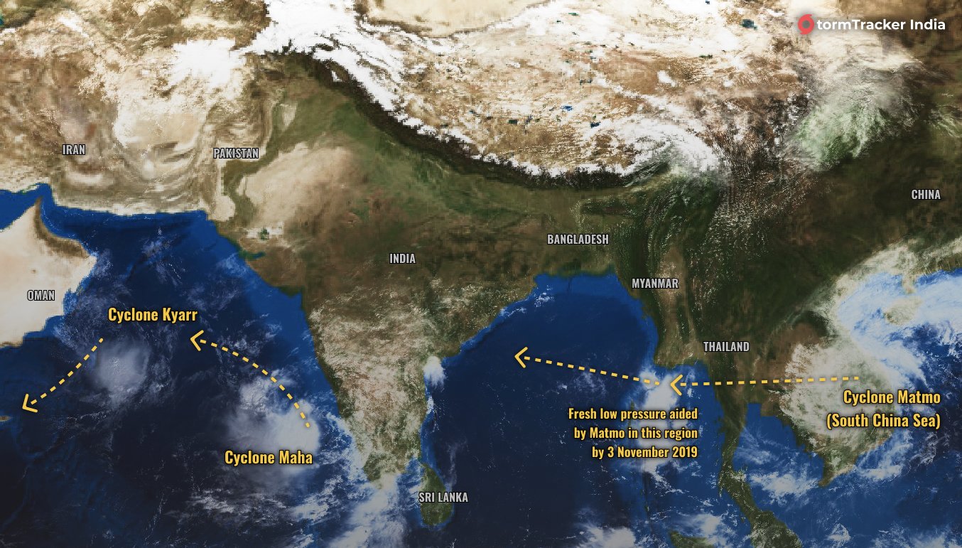
Tropical Cyclone Kyarr weakens along the south coast of Oman as Tropical Cyclone Maha rolls in behind.
The outer bands of Tropical Cyclone Kyarr continue to lash southern parts of Oman with large waves and heavy seas. The good news is that it is weakening, but heavy downpours could yet lead to flooding as the system heads towards the Horn of Africa.
Kyarr is currently located about 300 kilometres (186 miles) to the southeast of Masirah Island. The system is packing winds of 65km/h (40.4mph) with gusts nearer 85km/h (52.8mph).
At its peak, those winds were nearer 250km/h (155mph) making it equivalent to a Category 4 Atlantic hurricane. It is the strongest storm in the region since Tropical Cyclone Gonu in 2007 which achieved winds of 270km/h (168mph) and left 50 people dead.
Tropical Cyclone Kyarr is expected to maintain its current strength into the weekend as it heads towards the island of Socotra and then on towards the Puntland State of Somalia. Even though the system is expected to lose strength, daily rainfall totals of 50 to 100 millimetres are like to cause flooding.
In the meantime, there is another storm following on behind. The India Meteorological Department has issued an alert for Tropical Cyclone Maha which looks set to follow a similar track from the west coast of India towards Oman.
Warnings are in force for Lakshadweep and Kerala over the next two days. Fishermen in the region have been advised not to venture out to sea before November 2.
Maha has sustained winds of 110km/h (68.4mph) with gusts approaching 140km/h (87mph). It is expected to strengthen significantly as it crosses the Arabian Sea.
The Joint Typhoon Warning Center is predicting winds of 175km/h (109mph) gusting 215km/h (134mph) by next Tuesday as the system approaches the south coast of Oman coast. This second storm in a week could be even more disruptive than Kyarr.
https://www.aljazeera.com/news/2019...45.html?utm_source=dlvr.it&utm_medium=twitter

