Huur
Huur = Horus
Cape Guardafui belonged to Egypt not Ancient Ethiopia (a different civilization)
Source:
A geographical survey of Africa : its rivers, lakes, mountains, productions, states, populations
&c. with a map of an entirely new construction, to which is prefixed a letter to Lord John Russell regarding the slave trade and the improvement of Africa
by James McQueen, 1840
https://archive.org/details/geographicalsurv00macq


"The trade of Berbera is Chiefly in the hands of the Arab tribes called Somaulis, and one part where much of the trade is carried on, is called Bunder-cassim (Bosaso)..."
:siilaanyosmile:


Map of Africa
from 5.° south to 18.° North Latitude
and from 5.° to 44.° East Longitude
Constructed from the Latest Authorities by
James McQueen Esq. 1843

[Link]
[Link]
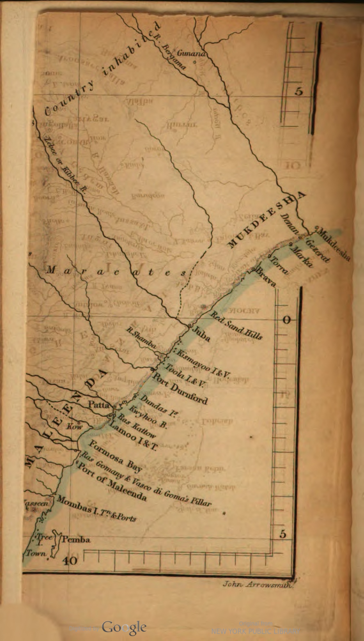
NOTE: Territories below Brava were NOT considered Somali territories at this time (1843).
If you take a look at the full map again, the regions we now know as the (Ogaden/Somali Galbeed/K5) was considered to be known as "The whole of this country inhabbited by the Galla Tribes" ... in 1843
Source:
A geographical survey of Africa : its rivers, lakes, mountains, productions, states, populations
&c. with a map of an entirely new construction, to which is prefixed a letter to Lord John Russell regarding the slave trade and the improvement of Africa
by James McQueen, 1840
https://archive.org/details/geographicalsurv00macq
"The trade of Berbera is Chiefly in the hands of the Arab tribes called Somaulis, and one part where much of the trade is carried on, is called Bunder-cassim (Bosaso)..."
:siilaanyosmile:
Map of Africa
from 5.° south to 18.° North Latitude
and from 5.° to 44.° East Longitude
Constructed from the Latest Authorities by
James McQueen Esq. 1843
[Link]
[Link]
NOTE: Territories below Brava were NOT considered Somali territories at this time (1843).
If you take a look at the full map again, the regions we now know as the (Ogaden/Somali Galbeed/K5) was considered to be known as "The whole of this country inhabbited by the Galla Tribes" ... in 1843
Last edited:


 Your first link says Breasted died in 1935 at the age of seventy. Your second link and quote says Egyptians developed the square sail to drive ships up and down the Nile. This has nothing to do with Punt or Guardafui. You are quoting irrelevant authors and data in one long troll.